Minister’s Speech for GIS Day 2015
Minister Responsible for Physical Planning & GIS
Hon Claude E S Hogan
“Today, November 18, 2015 is a day in observation of when the old science of geography met computers and computer systems. It is called GIS Day. GIS Day provides a forum for users of Geographic Information Systems (GIS) technology to demonstrate real-world applications that are making a difference in our society and our homes. In addition, this event provides an opportunity for those interested or curious about GIS, beyond the GPS system on your on mobile telephone, to see other GIS applications in action.

“Since its initiation in 2001, with help from the United Nations Development Program (UNDP) and the UK Department for International Development (DFID), Montserrat’s GIS has become an important tool and main source of data for most of our resource management, environment planning and infrastructure development projects on our island.
“This Year 2015 witnessed numerous applications of Montserrat’s GIS capability into projects of vital importance in the rebuilding of the island and its sustainable development. These include invaluable support to the development of Geothermal Energy on island; such as mapping the location of the 1st and 2nd drilling wells; as well as the potential location for the 3rd drilling well and incorporating this data into the environmental impact assessment for further analysis and discussion.
“Our Montserrat Blue Halo Project Partner, the Waitt Institute has also incorporated our GIS data into their Sea Sketch program to help develop a comprehensive management of Montserrat’s marine environment. This has strong and positive commercial value for the future and will enable us to right now advance sustainable fisheries and coastal zoning for Montserrat. We will know where all the best fishing zones are and know where to avoid the loss of fish-pots in the precipices beneath our seas; where to take action to protect and conserve; as part of our contribution to the impact of global climate change and saving other species of life.
“Furthermore, GIS has provided and will continue to provide support to our local Statistics Department in collecting census data. Our own GIS Unit will also be supporting the deployment of Montserrat’s National DevInfo System, which enables the storage and dissemination of National Statistical Data.
“Our GIS online mapping service at – http://landinfo.gov.ms has provided countless benefits to users online, both resident and in the diaspora. As I Understand it, one can go online from anywhere in the world and visit land sites and plan their purchase and tax support going forward.
“Our available records of cadastre have been computerized and linked with this facility in order to provide real-time interactive data query services to the general public about their land properties.
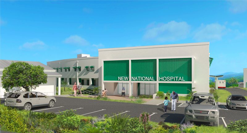
“The system is capable of facilitating various queries in relation to the island’s physical planning and infrastructure development and you might soon see our new hospital project site clearly highlighted on updated maps from the GIS Unit in our Ministry of Agriculture, Trade, Land, Housing and the Environment. Moreover, I should tell you that this GIS online business provides an additional revenue stream for the Government of Montserrat to help us offset our budget for education, health, roads and the like. Efforts are being made to develop other components and allied services and perhaps to incorporate pay online from where-ever you are in the world in collaboration with local private sector partners and of course DITES, our Department of Information and Technology and E-government Services. I suspect that our GIS Unit team cannot wait for Montserrat to be connected to the International Information Super Highway, after the MCWL Ministry oversees the landing of a fibre-optic cable at a point on one of our beaches very soon.
“Our GIS Team also acts regionally and brings home the benefits.
“A most recent OECS project, with its emphasis on mitigating hazards associated with climate change will provide our GIS Team with additional resources to enable easy retrieval of field based information. They will be receiving Hand-held GPS units with built in cameras and laptops that will allow the team to be more efficient in the collection of the data used in the GIS System that is continuously being built for Montserrat.

“Geographic information system (GIS) technology is a growing industry and new innovations are constantly being developed. Unmanned aerial vehicles (UAVs) or drones are now being utilized to acquire instant imagery and to help solve problems in such areas as environmental protection, pollution, health care, land use, natural resources, conservation, disaster management and crime activity.
“This year’s GIS Day celebrations will also promote geographic literacy in our schools and allow students to experience firsthand this exciting technology.
“Come and celebrate GIS Day with us today Wednesday, November 18th 2015 at the Physical Planning Unit in Brades. OPEN HOUSE runs from 11:00am – 3:00pm and all are welcome. If you don’t see me there, don’t worry. You can catch me on line. We are all GIS savvy today.
“It is therefore with great pleasure that I declare GIS DAY 2015 OPEN !”
Discover more from Discover Montserrat
Subscribe to get the latest posts sent to your email.


