The Antigua and Barbuda Meteorological Service has issued a tropical cyclone information statement advising that a tropical wave over the eastern tropical North Atlantic could develop into a tropical depression or storm later this week or early next week.
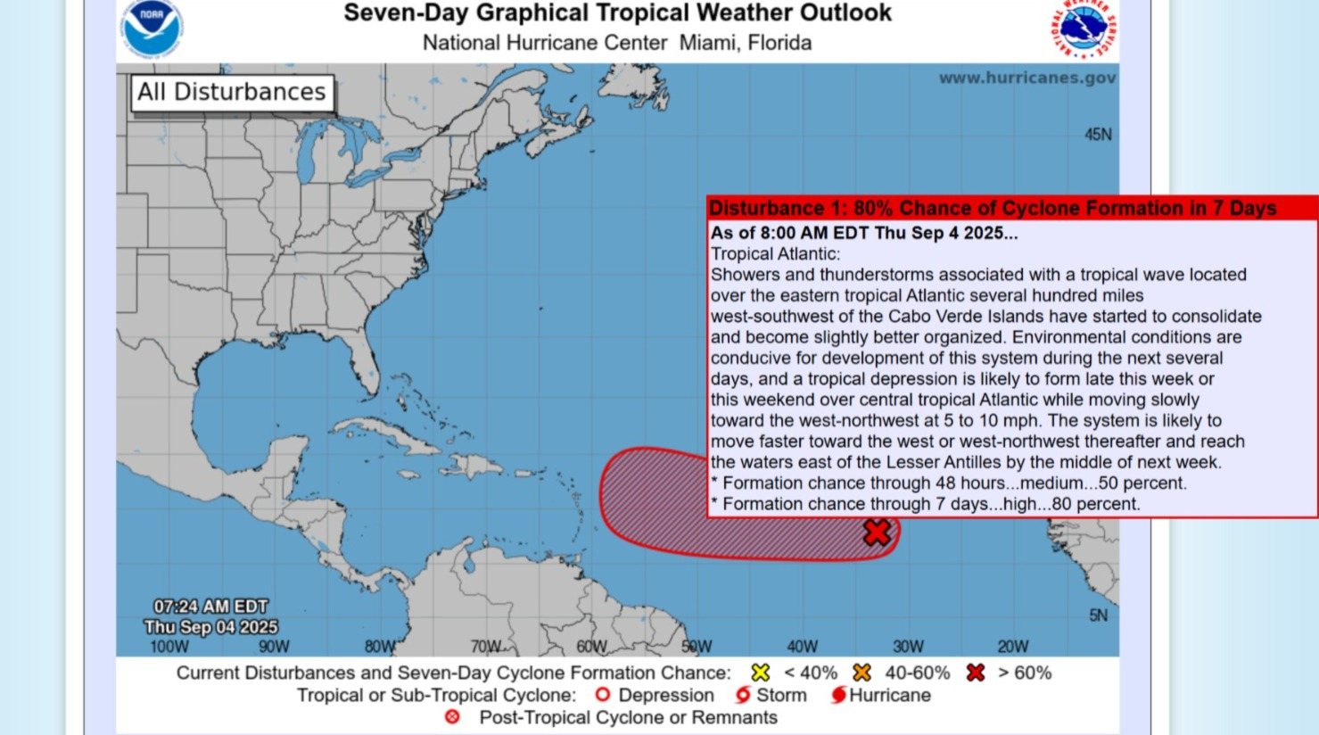
At 8AM Thursday, the system was located approximately 1,916 miles east-southeast of Antigua and Barbuda and the Leeward Islands, moving west at about 9 mph. Maximum sustained winds were recorded near 25 mph, with higher gusts.
Forecaster Dale Destin noted that the wave has become better organised over the past 12 hours and is “looking the most impressive to date.” While the system’s exact development timeline and potential impact on the region remain uncertain, residents of Montserrat are advised to monitor the situation closely and ensure they remain prepared for the remainder of the hurricane season.
The probability of the system forming into a tropical cyclone within the next 48 hours is rated medium at 50 percent, while the seven-day formation chance is high at 80 percent. Currently, no tropical cyclone alerts, watches, or warnings are in effect, though these may be required in the coming days.
The next update from the meteorological service is expected around 2PM Friday, or sooner if conditions change.
Discover more from Discover Montserrat
Subscribe to get the latest posts sent to your email.