Montserrat remains under a Tropical Storm Watch as Tropical Storm Jerry continues to strengthen while moving west-northwestward across the Atlantic toward the northern Leeward Islands.
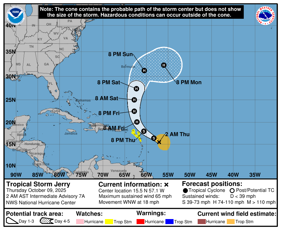
According to the Caribbean Disaster Emergency Management Agency (CDEMA), Tropical Storm Jerry was located near latitude 14.9° North, longitude 55.4° West at 8 p.m. Tuesday, about 560 miles (900 kilometres) east-southeast of the northern Leeward Islands. The system is moving west-northwest at 21 mph (33 km/h), with maximum sustained winds near 65 mph (105 km/h) and a minimum central pressure of 999 millibars (29.5 inches).
The National Hurricane Centre (NHC) reports that Jerry remains a sheared but organised storm. While wind shear is expected to persist, warm sea temperatures and a moist atmosphere could allow for gradual strengthening, and the storm may reach hurricane intensity by Friday if conditions briefly improve.
On the current forecast track, the centre of Jerry is expected to pass near or to the northeast of the northern Leeward Islands late Thursday into Thursday night, bringing tropical-storm-force winds extending up to 175 miles (280 km) from the centre.
Expected Impacts
CDEMA advises that tropical-storm conditions are possible from late Thursday into Thursday night, with sustained winds of 40–60 mph (65–95 km/h) and higher gusts in squalls near the outer bands.
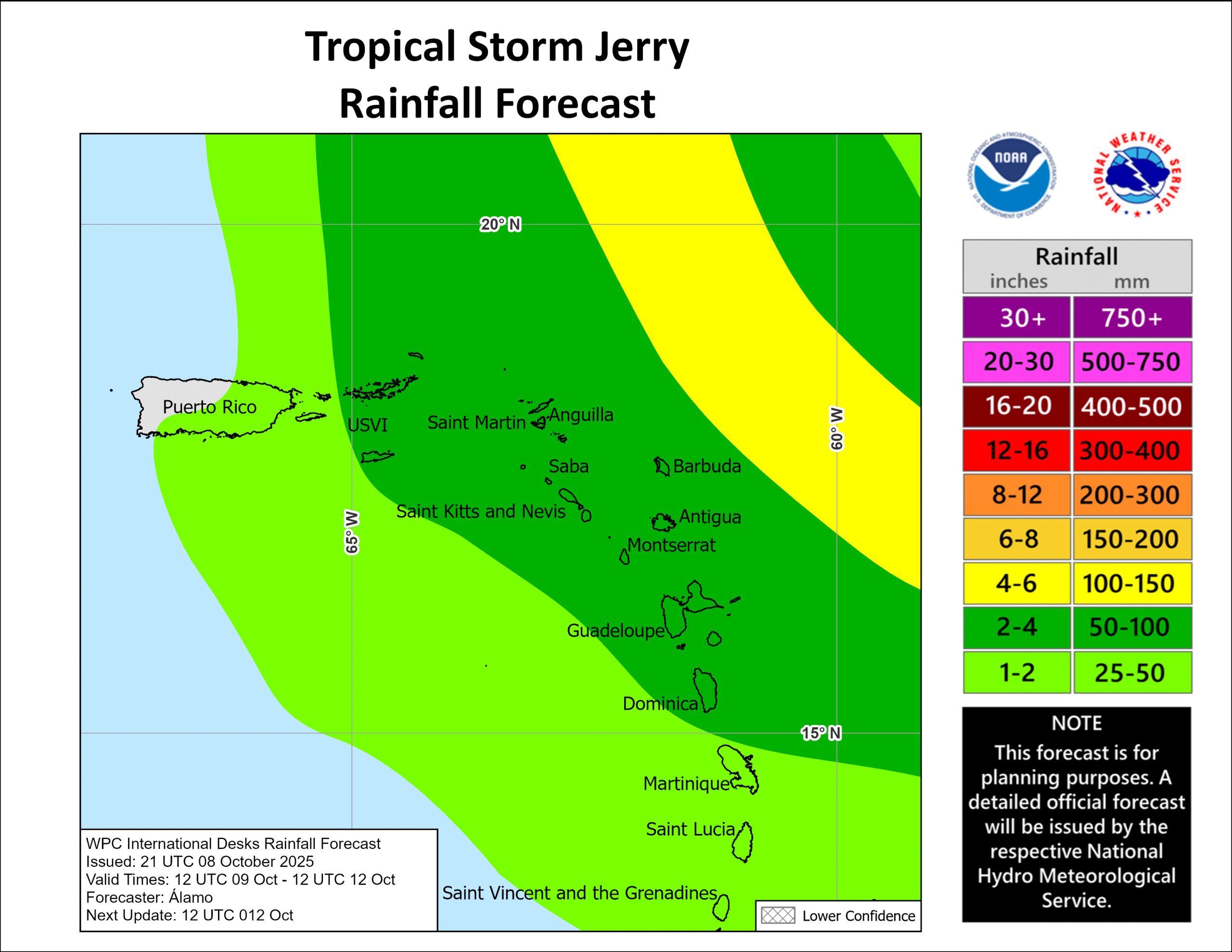
Rainfall totals of 2 to 4 inches (50–100 mm) are forecast across the Leeward Islands from Thursday through early Saturday, with up to 6 inches (150 mm) possible in mountainous areas. Given the recent saturation from the October 7 tropical wave, flash flooding and landslides are possible, especially in steep terrain.
Seas are expected to deteriorate significantly, with wave heights of 4 to 6 metres, rough to very rough surf, and dangerous rip currents along north and northeast-facing shores from Thursday through Friday.
Local Preparations
The Disaster Management Coordination Agency (DMCA) has confirmed that a Tropical Storm Watch remains in effect for Montserrat.
DMCA Director has briefed the Governor on ongoing national preparations. The agency has also established communication with the National Office of Disaster Services (NODS) in Antigua and Barbuda, which serves as the Eastern Sub-Regional focal point for CDEMA coordination.
Work crews are currently clearing major waterways and drains, particularly in flood-prone areas. Emergency shelters are ready for activation if needed, though they remain closed at this time. Risk communication and public awareness messages have been amplified across all official and social media channels.
Residents are urged to review their family emergency plans, monitor official updates closely, and take the necessary steps to protect life and property.
A national coordination meeting is scheduled for Thursday, October 9, to review updated forecasts and determine next steps as the storm approaches.
The DMCA will continue to monitor the system’s progress and issue updates as conditions evolve.
Discover more from Discover Montserrat
Subscribe to get the latest posts sent to your email.