The Antigua and Barbuda Meteorological Service is warning that Tropical Storm Erin could pass dangerously close to the Northeast Caribbean later this week, with the potential to strengthen into a hurricane by Friday.
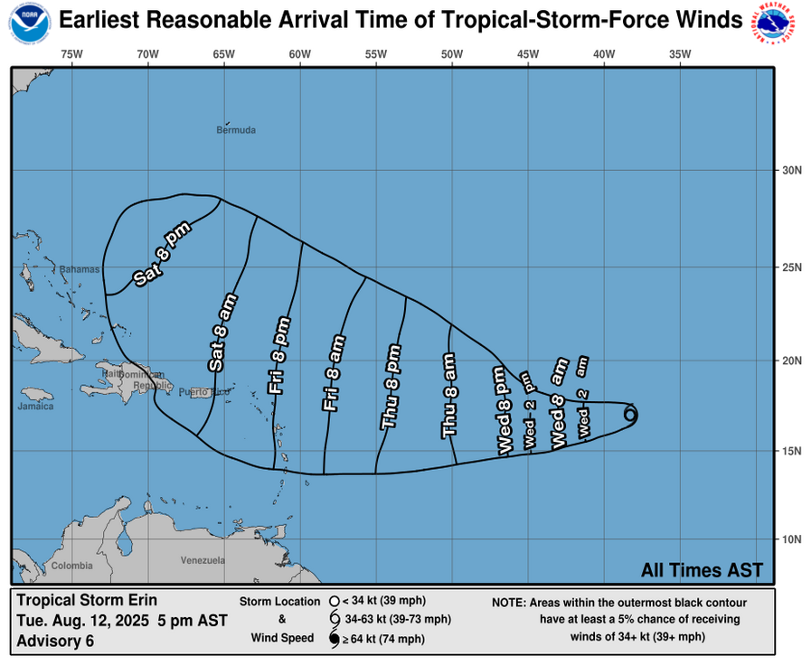
As of 5PM ECT today (Tuesday, August 12), Erin was located about 1,544 miles East of Antigua and Barbuda, moving quickly West at around 22 mph. Maximum sustained winds are near 45 mph, with higher gusts. Little change in strength is expected over the next 24 hours, but gradual intensification is forecast to begin late Wednesday.
Current projections keep the centre of Erin North of the islands; however, a shift to the South could bring the storm’s core dangerously close to Antigua, Barbuda, the rest of the Leeward Islands, and the British Virgin Islands late Friday or Saturday. The likelihood of tropical storm-force winds reaching the area has risen to approximately 33 percent.
There are currently no cyclone alerts, watches, or warnings in effect, but forecasters say an alert could be issued as early as tomorrow. Residents in the Leeward Islands and BVI are urged to closely monitor updates and ensure they are prepared for the remainder of the hurricane season.
The next official update from the Antigua and Barbuda Meteorological Service is expected at 5 p.m. tomorrow, or earlier if conditions change.
Discover more from Discover Montserrat
Subscribe to get the latest posts sent to your email.