The National Hurricane Center (NHC) is advising residents across the Atlantic Basin to monitor the progress of Tropical Storm Erin, which is currently moving westward across the eastern Atlantic and is forecast to become a hurricane later this week.
As of 5AM EDT on Tuesday, Erin was located near latitude 17.4 North, longitude 34.3 West — about 600 nautical miles west of the Cabo Verde Islands. The storm is moving west at 19 knots (approximately 22 mph) with maximum sustained winds of 40 knots (46 mph) and gusts up to 50 knots. Its minimum central pressure is estimated at 1004 millibars.
Seas up to 12 feet are reported within 90 nautical miles of the storm’s centre in the northeastern quadrant and 30 nautical miles in the northwest quadrant. Satellite imagery shows bands of moderate to strong thunderstorms concentrated mainly in the southern semicircle, with scattered moderate convection to the north.
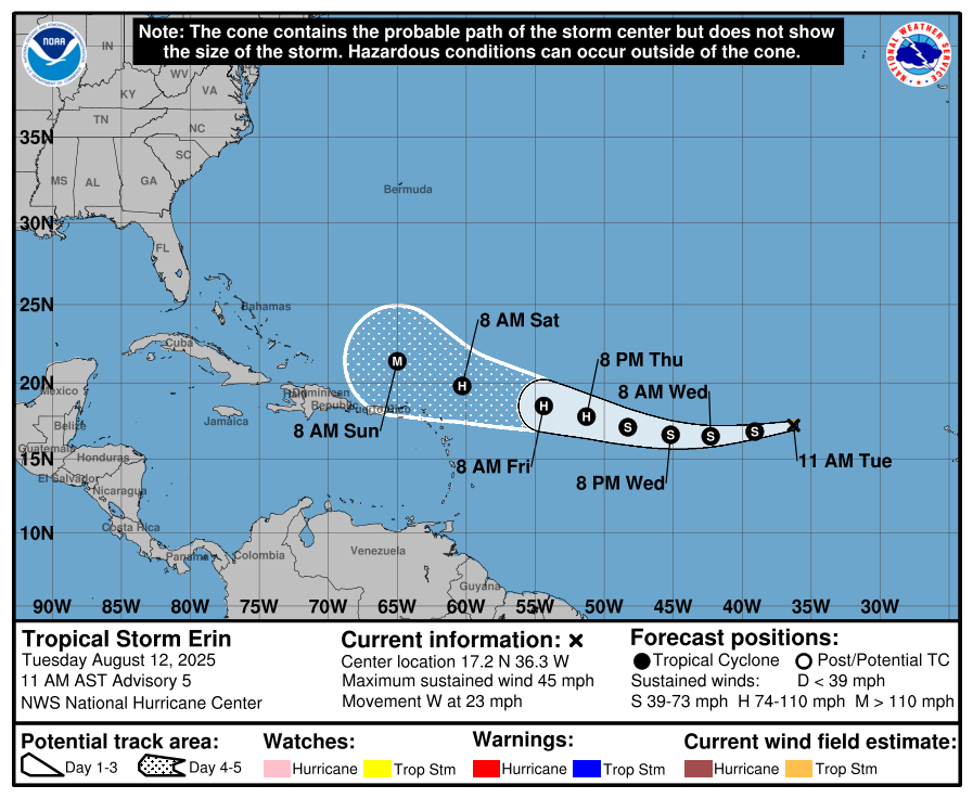
Erin has shown little change in strength overnight, according to the NHC, but conditions ahead are expected to support intensification. “Low wind shear and increasingly warm sea surface temperatures are favourable for strengthening,” the NHC noted. “Erin is forecast to become a hurricane later this week.”
The storm is being steered by a ridge of high pressure to its north and is expected to continue on its westward path for the next several days, with a gradual decrease in forward speed. The official forecast calls for Erin to reach hurricane strength near 17.4N 46.8W by Thursday morning and to move northeast of the Leeward Islands early Saturday.
While no coastal warnings or watches are currently in effect, forecasters caution that long-range forecasts are subject to change and urge residents of the Lesser Antilles and surrounding areas to stay informed.
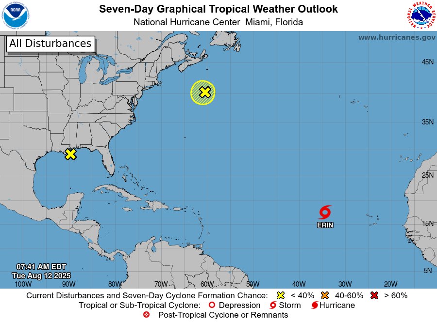
Elsewhere in the Atlantic, a strong pressure gradient between high pressure north of the basin and low pressure over Colombia is expected to produce fresh to strong winds and moderate to rough seas offshore Venezuela and Colombia through Wednesday night, particularly during nighttime hours.
Discover more from Discover Montserrat
Subscribe to get the latest posts sent to your email.