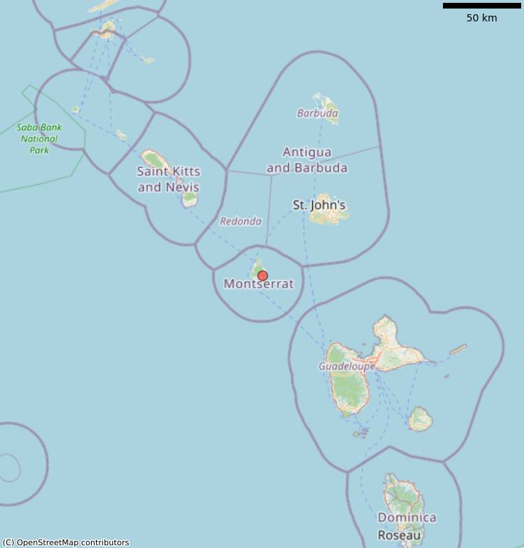
Flights to and from Montserrat have been cancelled for Thursday as a Tropical Storm Watch has been issued for Montserrat and neighbouring islands.
Isaac, spent a short period of time as a hurricane before being downgraded to a tropical storm on Tuesday. It is expected to impact Montserrat during Thursday.
Captain Nigel Harris of Fly Montserrat said flights should remain normal through Wednesday unless increase in winds warrants a change to the timetable. He said no flights will be operated on Thursday, while Friday will be dependent on weather conditions.
On Tuesday afternoon, the meteorological service of Antigua and Barbuda issued a Tropical Storm Watch for St. Kitts and Nevis, Antigua and Montserrat. There are hurricane watches in effect for Guadeloupe, Martinique, and Dominica.
A Hurricane Watch means that hurricane conditions are possible within the watch area. A watch is typically issued 48 hours before the anticipated first occurrence of tropical-storm-force winds, conditions that make outside preparations difficult or dangerous.
A Tropical Storm Watch means that tropical storm conditions are possible within the watch area, generally within 48 hours.
Interests elsewhere in the Leeward Islands should monitor the progress of Isaac as additional watches could be issued this afternoon or evening.
For storm information specific to your area, please monitor products issued by your national meteorological service.

DISCUSSION AND OUTLOOK
———————-
At 200 PM AST (1800 UTC), the center of Tropical Storm Isaac was located with high-resolution GOES-16 visible satellite data near latitude 14.6 North, longitude 50.4 West. Isaac is moving toward the west near 16 mph (26 km/h), and this motion is expected to continue for the next few days. On the forecast track Isaac is anticipated to move near or over the central Lesser Antilles on Thursday and move into the eastern Caribbean Sea Thursday night.
Maximum sustained winds remain near 70 mph (110 km/h) with higher gusts. Isaac is expected to be near hurricane strength when it moves through the central Lesser Antilles, with some weakening forecast afterward on Friday.
Tropical-storm-force winds extend outward up to 105 miles (165 km) from the center.
The estimated minimum central pressure is 996 mb (29.42 inches).
HAZARDS AFFECTING LAND
———————-
RAINFALL: Isaac is expected to produce total rainfall accumulations of 3 to 5 inches with isolated amounts near 10 inches across the southern Leeward Islands late this week, with 1 to 2 inches anticipated across portions of the Windward Islands.
STORM SURGE: A storm surge of 2 to 4 feet above normal tide levels is possible near and to the north of where the center moves through the Lesser Antilles. Near the coast, the surge will be accompanied by large and destructive waves.
WIND: Hurricane conditions are possible within the hurricane watch area by Thursday morning, with tropical storm conditions possible early Thursday in both the hurricane and tropical storm watch areas.
SURF: Swells generated by Isaac will begin to affect portions of the Lesser Antilles on Wednesday afternoon. These swells are likely to cause life-threatening surf and rip current conditions.
Please consult products from your local weather office.
Discover more from Discover Montserrat
Subscribe to get the latest posts sent to your email.


