For a small island, the ocean provides livelihoods, tourism, relaxation, and a sense of national pride for the people of Montserrat. But figuring out how to use these resources wisely whilst still supporting the people who love and benefit from the ocean is no easy task. The Government of Montserrat and countless individuals have been working for three decades to create a plan to sustainably and fairly manage the ocean resources of our waters. This work has made tremendous progress these past few years due to the dedication of our community and the launch of Blue Halo Initiative on Montserrat in 2015. Each week, I will be featuring an individual who has been working to build a more sustainable and abundant ocean future for Montserrat.
Lavern Rogers-Ryan already had 15 years of experience and two Masters of Science degrees in Geographic Information Science and Spatial Planning with Sustainable Urban Design to her name when she was invited to join Blue Halo Montserrat Steering Committee. Blue Halo Montserrat is an initiative of the Waitt Institute, which endeavors to ensure ecologically, economically, and culturally sustainable use of ocean resources. The goal is to benefit coastal communities while restoring fish populations and habitats, in partnership with governments and local stakeholders. The Institute has developed similar programs on Barbuda and Curacao.
As head of the Government of Montserrat’s Geographical Information Systems department, Lavern is responsible for managing spatial data on demography, hazards, infrastructure, land cover, physical geography among others. She was invited to be a part of the process of developing the island’s marine spatial plan. “The topic of spatial planning was not new to me at the start of the Blue Halo project, as I had just completed a Masters in that subject in 2014. However, as the focus of my study was on sustainable urban design, I was happy to learn more and apply my knowledge to the marine environment.”
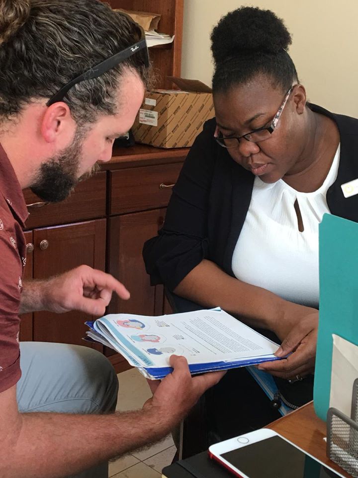
Apart from the work required to complete her group and university assignments, Lavern had not explored areas of ocean mapping and planning. She got her first taste of this when the SeaSketch application was introduced as part of the Blue Halo Initiative.“SeaSketch is a web-based application that you can use to contribute information concerning the distribution of activities and resources in and around Montserrat’s waters. Where people fish, what are they fishing for, where are yachts moored, where ships come in,” explained the developer Dr Will McClintock. “It can also be used to show the distribution of fish and the size.”
A team of 12 scientists worked with Blue Halo Montserrat and local partners in November 2015 to conduct dive surveys to assess reef fish, corals, and other living organisms. The data gathered through the application was used to facilitate the design of the marine spatial plans and the relevant policies for ocean zoning which then informed the creation of applicable laws.
“My first impression about the SeaSketch team was that they were very knowledgeable, innovative, and very easy to talk to. I was deeply intrigued and fascinated when Will showed me firsthand how the application was to be used. I was not new to mapping applications, however this one was different in that it allowed for public participation in the planning process. The public was able to share comments and draw directly into the application to highlight or raise concerns about anything that was discussed or which was a personal priority for them,” explained Rogers-Ryan.
The data collected from the application continues to help the GIS manager in her work. “I have since utilized SeaSketch by analyzing several layers of data which were compiled and have incorporated this data into other applications for the Government of Montserrat.”
“Prior to the Blue Halo project, most of the spatial data housed by the GIS Centre was terrestrial or land based. The project allowed for marine data to be collected and further used in the decision-making process. For example, some dives were undertaken around the island, which helped to ascertain exactly what resources we had under the water and this further helped in identifying our benthic habitat. The output of this benthic habitat classification and other surveys have helped to provide context to other projects that have now come on stream.” Benthic habitats are physically distinct areas of seabed that are associated with particular species.
Increasing local capacity for ocean management is beneficial for the future of marine spatial planning, so in 2017, Lavern had the opportunity to attend the Gulf and Caribbean Fisheries Institute Conference in Mexico. “Attending the GCFI Conference in Mexico was especially eye opening for me. It provided an opportunity to learn from and engage with persons who faced similar challenges in their fisheries sectors.
What stood out most to me were the success stories of the people and territories that welcomed marine protected areas in their waters. Some of the fishermen, whose livelihoods were affected, re-purposed their skills into becoming wardens, so that these areas can be managed appropriately.”
From the onset of the project, a Blue Halo Steering Committee was formed. This was to ensure that local experts, including the Ministry of Agriculture, which has responsibility for ocean resources, the Montserrat National Trust, the fisher’s associations, and other groups took ownership of the process of planning how to manage and protect the island’s marine resource. Lavern is now part of that the committee and uses her newly acquired skills and experience to contribute to the roll out of the marine spatial plan.
“As a member of the steering committee, I engage in discussions and facilitate the conversation by recording notes and highlighting concerns using the SeaSketch App. This is further used in drafting and re-drafting the marine spatial plan based on the outcome of these discussions. The committee, which is made up of people from the public and private sector, comes to a consensus by voting and providing advice to guide the marine spatial planning process by informing the Minister of Agriculture of our decisions.”
Rogers believes the Blue Halo Montserrat project has been good for the island. Along with providing the technical support to improve Montserrat’s marine environment data sets and increasing local knowledge and capacity to lead in implementing the marine spatial plan, “the project allowed for discussions on how we manage our limited marine resources, while planning for sustainable use so that future generations can still have access to what we currently enjoy,” Rogers-Ryan shared. “I think it is possible to find a happy medium between protecting our resources and our fishers making a livelihood. Other places have been successful in doing so but it requires a change in behavior and persons would need to be willing to make adjustments.”
In February 2015, the Government of Montserrat and the Waitt Institute signed a Memorandum of Understanding that launched Blue Halo Montserrat. The goal is to foster the sustainable, profitable, and enjoyable use of ocean resources for present and future generations. Over a five-year period, it has developed and drafted sustainable ocean policies and a marine spatial plan through a process that deeply engages stakeholders and is based on scientific, social, and economic data. Other partners of the Blue Halo Initiative include the Ministry of Education, Youth Affairs and Sports, the Ministry of Agriculture, Lands, Housing, and the Environment, the Montserrat National Trust.
Discover more from Discover Montserrat
Subscribe to get the latest posts sent to your email.